Understanding the Tapteal Trail Documents Simply
🌲 VOLUME II — THE TAPTEAL TRAIL INVESTIGATION
📄 HRF-2001
The Paper Trail
How a 2022 Planning File Became Part of a 2026 Investigation
Overview
Long before anyone questioned a retaining wall, City staff were discussing how the future Tapteal Trail would be incorporated into the Quail Ridge II development.
This brief explores the original planning discussions, the proposed trail corridor, Parcel B, and the planning decisions that resurfaced years later during the 2026 investigation.
What's Covered
Quail Ridge II planning discussions
Proposed Tapteal Trail corridor
Parcel B and Tract D
Easement language
Early planning history
Why It Matters
This chapter provides the foundation for understanding everything that follows in the Tapteal Trail investigation.
Where the Story Goes Next
Planning documents tell us what was intended.
The next question is:
What happened once construction began?
➡️ Continue to HRF-2002 – A Citizen Notices Something Isn't Right
📄 HRF-2002
A Citizen Notices Something Isn't Right
Overview
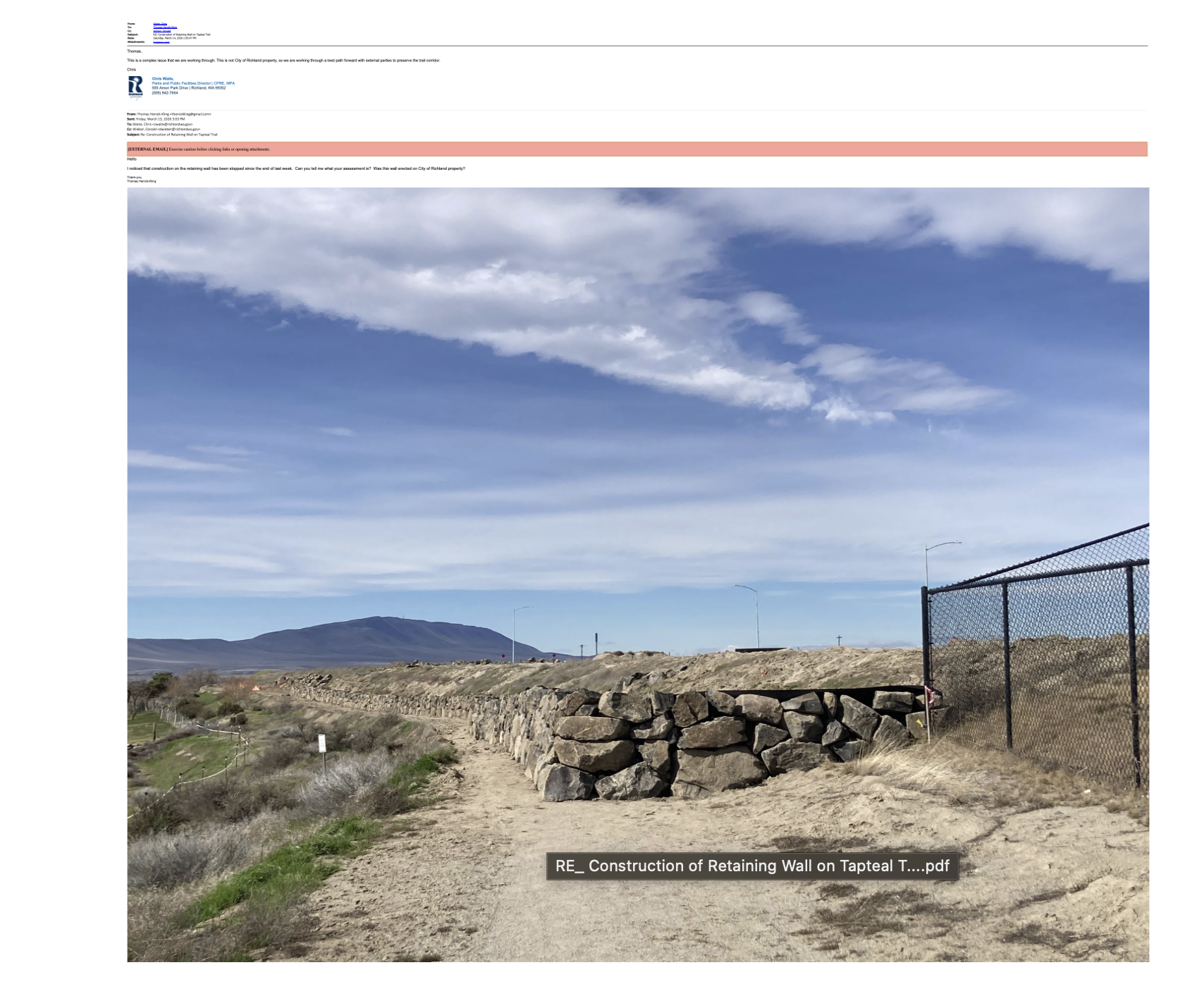
Construction begins, and a homeowner notices something that doesn't seem to match the planned trail corridor.
Questions are sent to the HOA and the City, setting in motion the series of events that would eventually involve multiple City departments.
What's Covered
Initial homeowner concerns
Early photographs
HOA communications
City's first response
Why It Matters
Every investigation has a starting point. This is where the public record begins.
Where the Story Goes Next
The City has now been notified.
How does the concern move through City Hall?
➡️ Continue to HRF-2003 – Inside City Hall
📄 HRF-2003
Inside City Hall
Overview
As questions reach City Hall, Planning, Building, Parks, Engineering, and City leadership begin working together to understand what happened and determine the next steps.
This chapter follows the internal communications as the investigation unfolds.
What's Covered
Internal City communications
Department coordination
Planning and Building discussions
Initial investigative response
Why It Matters
This chapter shows how information moved through City Hall as staff worked to understand the issue.
Where the Story Goes Next
As more information is gathered, attention shifts from discussion to action.
➡️ Continue to HRF-2004 – The Stop Work Investigation
📄 HRF-2004
The Stop Work Investigation
Overview
The Building Division reviews permits, conducts inspections, and evaluates whether construction should continue while additional questions are answered.
This chapter follows the City's enforcement response during the early stages of the investigation.
What's Covered
Building Division review
Site inspections
Stop Work Order
Permit discussions
Construction oversight
Why It Matters
This chapter documents the City's response after concerns were raised about active construction.
Where the Story Goes Next
As inspections continue, a larger question begins to emerge:
Who owns the trail corridor, and what was originally intended?
➡️ Continue to HRF-2005 – Who Owns the Trail?
📄 HRF-2005
Who Owns the Trail?
Overview
As the investigation continues, one question rises to the surface:
Who owns the land, and how was the future trail corridor intended to be preserved?
City staff review property records, plats, grading plans, easements, and earlier planning documents while working toward an answer.
What's Covered
Property ownership
Easement discussions
Parcel B
Tract D
Planning records
Grading plans
Why It Matters
Understanding the planning documents and property history helps explain why this issue became more complex than it first appeared.
Where the Story Goes Next
With the planning history in hand, City staff return to the site to compare the documents with conditions on the ground.
➡️ Continue to HRF-2006 – The March 17 Site Visit
📄 HRF-2006
The March 17 Site Visit
Overview
City staff return to the site to compare the original planning documents with conditions on the ground.
Photographs, measurements, and field observations become an important part of the continuing review.
What's Covered
March 17 site visit
Field photographs
Planning review
Contractor communications
Why It Matters
This chapter brings together planning history and on-site observations to provide a clearer picture of the trail corridor.
Where the Story Goes Next
The final chapter brings together the maps, photographs, and visual references that help illustrate the investigation.
➡️ Continue to HRF-2007 – The Visual Record
📄 HRF-2007
The Visual Record
Overview
Sometimes a photograph tells the story better than a stack of emails.
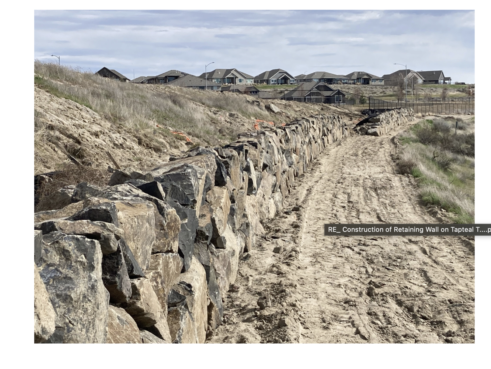
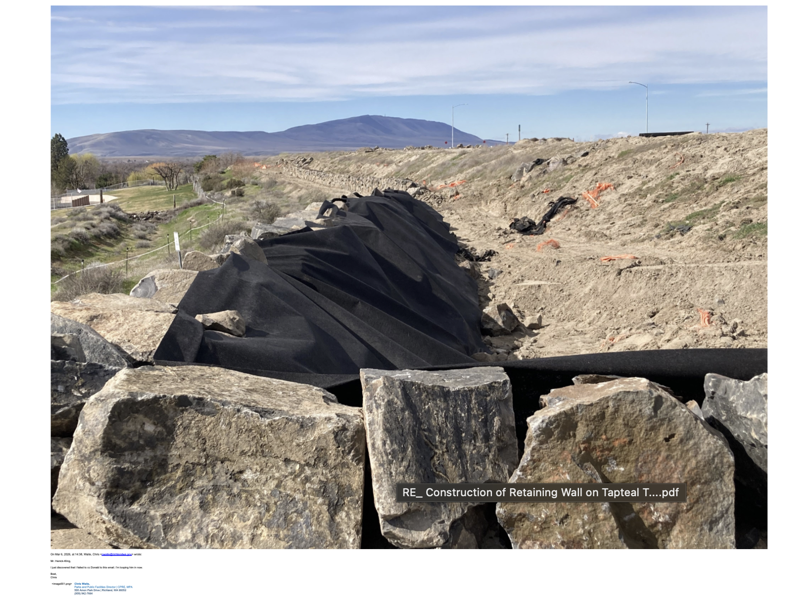
This chapter brings together the maps, aerial photographs, planning exhibits, construction photographs, and other visuals that help illustrate the Tapteal Trail investigation.
Rather than introducing new information, this section provides visual context for the documents and timelines presented throughout Volume II.
What's Covered
Annotated aerial photographs
Site maps
Construction photographs
Planning exhibits
Trail corridor comparisons
Reference images used throughout Volume II
Why It Matters
Visual records often make complex planning issues easier to understand. They provide context, show change over time, and help connect the locations discussed throughout the investigation.
Where the Story Goes Next
The Tapteal Trail Investigation is one chapter in the larger Horn Rapids Files.
Continue exploring:
➡️ Volume I – The Lawsuit
➡️ Volume III – HOA Governance
➡️ Volume IV – The Nexus (Who's Who)